

Get a usable plan
- Ask for CAD or PDF floor plans and export each floor as an image.
- No plans? Photograph the fire evacuation plan by the entrance, straight on.
- For outdoor areas, an aerial image or site layout works.
- Use one plan per floor or area, so pins stay readable.
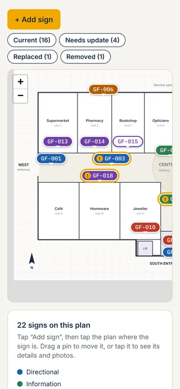
Pin each sign where it is
- Stand at the sign and find your position on the plan.
- Drop a pin; it takes the next number.
- Take a photo and set the sign type, status and details.
- Move on along your route. Drag a pin later if you need to adjust it.
Outdoor and large sites
Record the phone's GPS position against each outdoor sign as well as its pin on the site plan, so it can be found again on a large site.
Doing it on a phone
Signcensus does this in the phone's browser: upload the plan, tap to pin, photograph and fill in details, and every sign is numbered and listed. See how it works.
Questions
- What if I don't have a floor plan?
- Photograph the fire evacuation plan, draw a quick sketch and photograph it, or use an aerial image for outdoor areas. Any clear image can be pinned to.